Documenting Existing Conditions to Support Permitting & Compliance
The Challenge
An engineering team was tasked with advancing a facility design, but there was one major issue:
No accurate as-built drawings existed.
Without reliable documentation of existing conditions, they could not:
Move forward confidently with design
Verify floor slopes for secondary containment compliance
Complete required permitting documentation
The facility owner had attempted to draft the existing conditions internally, but the detail level was insufficient to meet engineering and regulatory requirements. They needed accurate, defensible, and complete documentation.
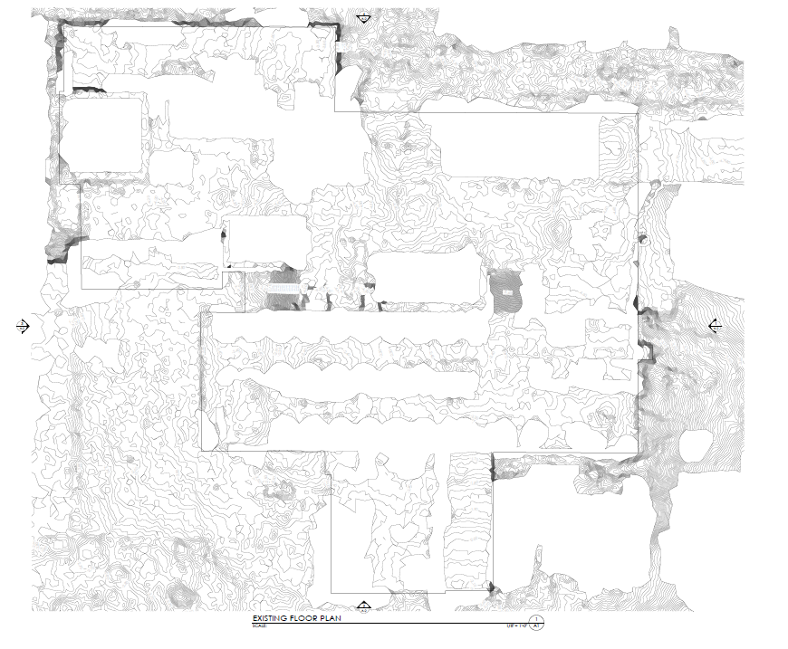
The Solution
Professional Drafting Service deployed 3D laser scanning technology to capture the full facility conditions.
Deliverables included:
Clean, processed 3D scan files
Accurate 2D facility drawings generated from the scan data
Unlike some scanning companies that deliver raw point clouds without refinement, the data was fully cleaned, structured, and converted into usable documentation tailored to the engineer’s needs.
The collaboration was described as: “Seamless.”
The Impact
The resulting drawings and scan data became the foundation for:
Permit submission documentation
Verification of floor slope compliance for spill containment regulations
Development of accurate design data
According to the client:
“The data collected and presented were crucial to developing the design information required to complete our permit process.”
The project ultimately saved time, improved accuracy, and eliminated uncertainty — allowing the engineering team to move forward confidently.
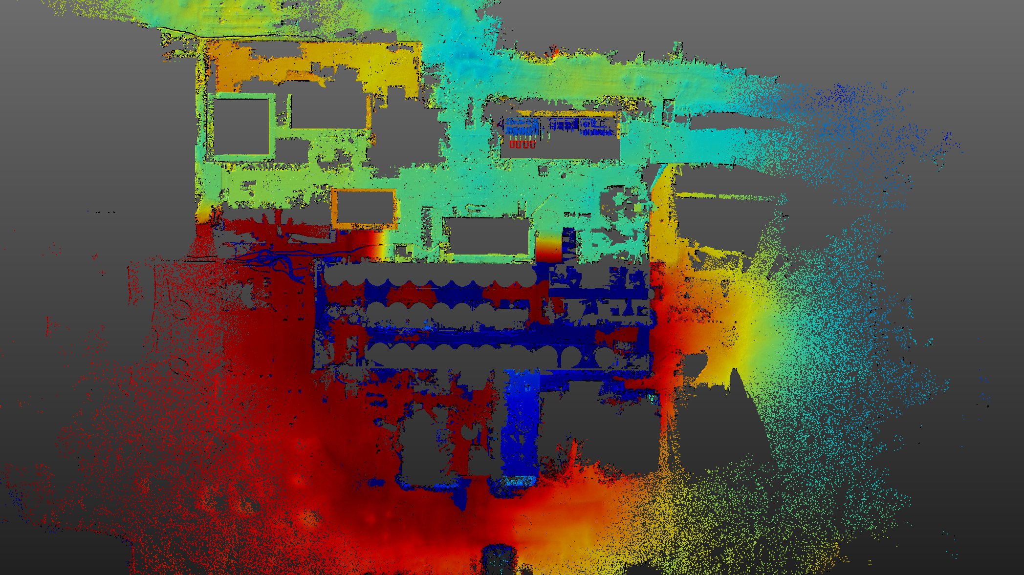
Point cloud with color based elevation: Red - High, Blue - Low